Thursday, October 2, 2014

Yellowjacket Mines (July 2, 2014)

A week before I made this trip, me and a friend had been backpacking up this area. He knew about the mines, so on the way down from our overnight backpacking trip, we dropped by the mines. We didn't go very far in because of our lack of proper gear, but decided to come back later.
017cdc7c0f0f1f26136ad0bae2bbd6c8a9ecd94c1d.jpg
I ended up coming back with the friend who showed them to me a week earlier and a third friend. We brought our climbing helmets and headlamps, along with cameras and lunch. Our hike in was about two and a half miles both ways. The trail wasn't too bad, but it crossed the stream multiple times.
As we neared the mines, we could see the tailing piles. There was also old mining equipment and the like. 
10404327_476196119181637_2854179106666219230_n.jpg

01ad3eace10865d5acf4794d539173f7b92a456b1b.jpg
In all, there were 3 mines. The largest went about 350 ft. back before it ended. Someone had sealed the passage off. The second mine was smaller and went about 150 ft. back. The smallest mine went no more then 40 ft. back. These mines were really cool. Reading up on them was even cooler. There is so much history in the Uinta Mountains.
10519184_476196715848244_3790907941126172806_n.jpg

10458013_476196865848229_6041122548089212218_n.jpg

Little Valley Mine and Cave (October 2, 2014)

This trip has been one of my favorites. I read about this mine on a few other blogs, and had to go. The pictures I had seen of formations were super cool. They were too good to miss out on before cold weather. The mine itself was very extensive with many different levels and entrances. The whole top of the ridge is dotted with shafts. Some of the shafts connect to form the big part of the mine, but many others are smaller shafts that end a little ways in. 
The mine part of the system was quite interesting. There are people who call this mine "The Lost Josephine." Personally, looking at the size of the mine, the charcoal markings in it, and the old timbers, I would say it was mined around the early 1900's. There are a few dates in there, ranging from 1914 to 1944. 
Normally, I would try and explain what going into the mine/cave was like (along with rough measurements and details) but this system is so extensive, that I wouldn't do it justice. You have to go see it yourself.
Before I went, I read up on the mine. While mining, the miners apparently broke into a cave system. The cave part of the mine was so amazing. The pictures I took can only slightly give credit to the beauty of the cave.


Throughout the cave and mine, there were many beer bottles and cans. It was definitely sad to see the liter around, and there was too much to take it all out. In the cave, there was quite a few broken formations. I suspect they were broken by inexperienced cavers who do not recognize the amount of time it takes to form these structures. There were also orange tags starting at 31 and going backwards into the cave. They were located at major formations with broken formations. They might have been put there by the Wasatch Grotto to mark the places for restoration.
The formations at the start of the cave were smaller, but as I got further back in they grew bigger. I got to a point where the whole room was a formation. All the walls were covered. This room was the most significant. Just past that room, there was a drop and I didn't have rope, so I turned back and decided to save it for later.
The layers of the formations were really thick. You could see the year to year growth. It was super cool. 
I am really excited to go back. Before I do, I am definitely doing more research and hoping to find that someone has mapped the cave and the mine system. The formations in this cave are the best I have seen in smaller and unknown cave systems.

Thursday, September 25, 2014

Dan Clyde Cave (September 24, 2014)

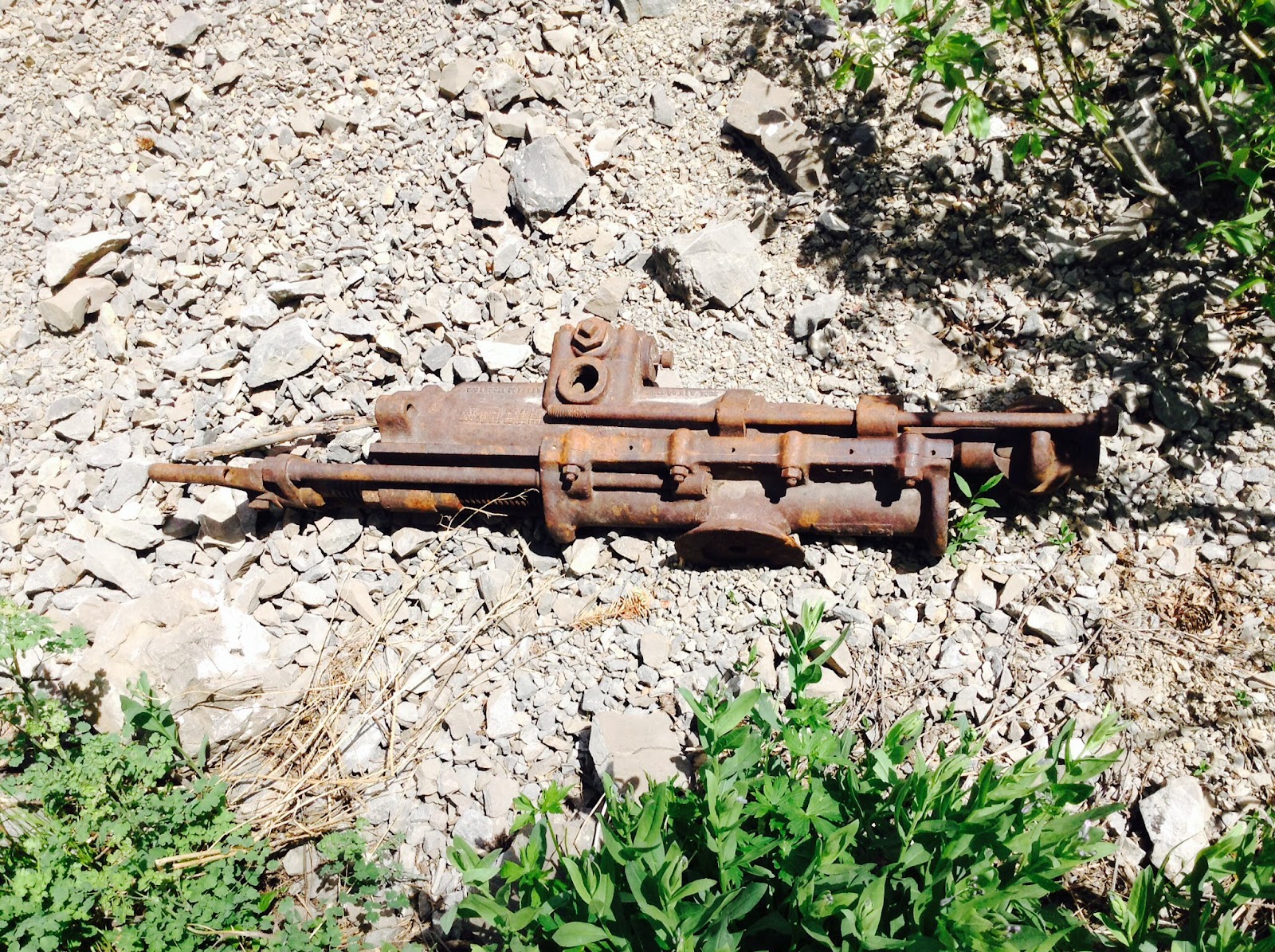
This past few weeks, me and one of my friends began planning this excursion. It didn't take too long to figure out gear situations, vehicles, and times. We invited one of our other friends and his father who is and experienced caver. We left at 3:15 pm, and four-wheeled up to the cave entrance. We arrived at around 4:30 and put all our gear on. We were expecting mud, wore our coveralls. 
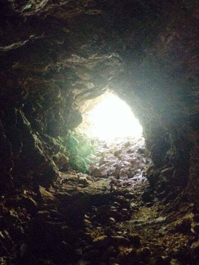
The opening to the cave is smaller, and doesn't look like much. As we entered, straight ahead of us, there was a 30 ft. drop. Off to the left, there was an easier way down. We used a hand line and climbed down quite easily. At the bottom, the room was about 25 ft. across in both directions and about 35-40 ft. high. The second drop was about 50-60 ft. We rigged our rope and began the second descent.

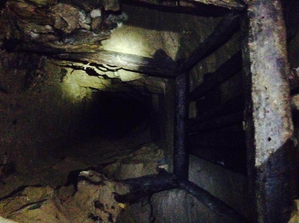
 The chamber at the bottom was about 30 ft. across and 50 ft. long. Both ends narrowed off into fissures. The upper passage wound upward and was a tight squeeze then a room etcetera kind of cave. In all, it had 5 rooms and 4 crawls/squeezes in-between each room. 

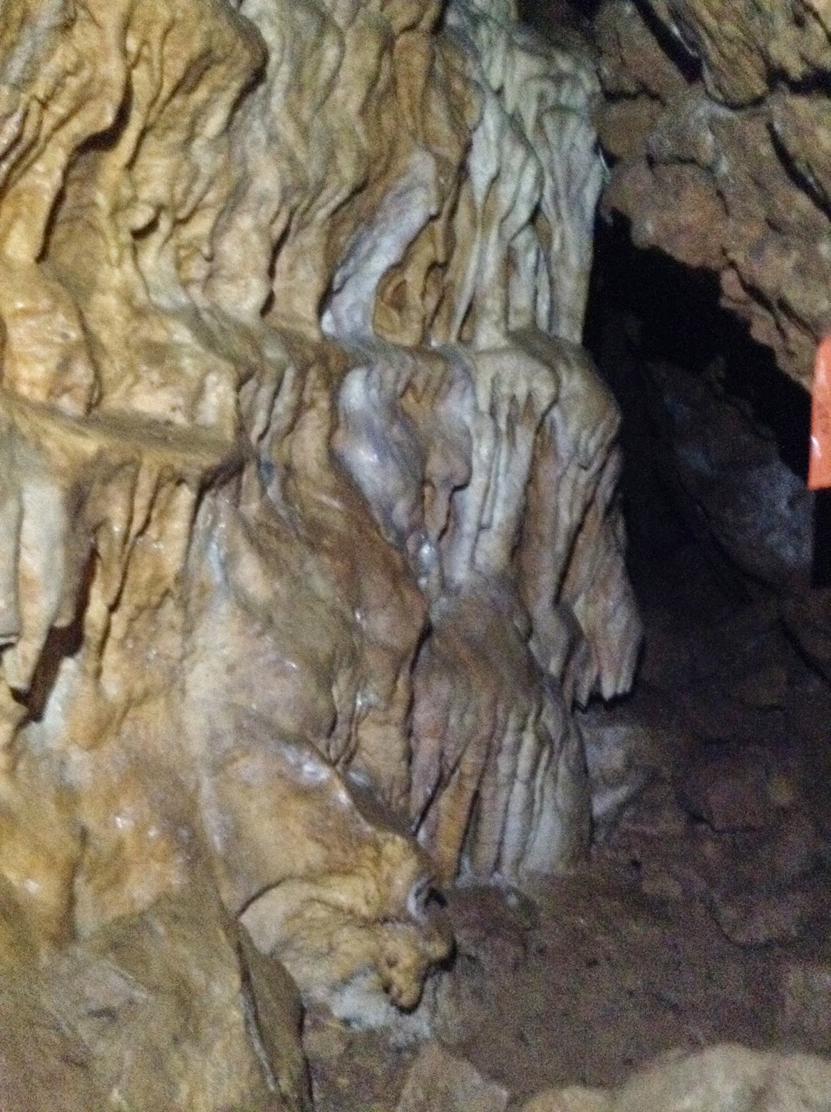
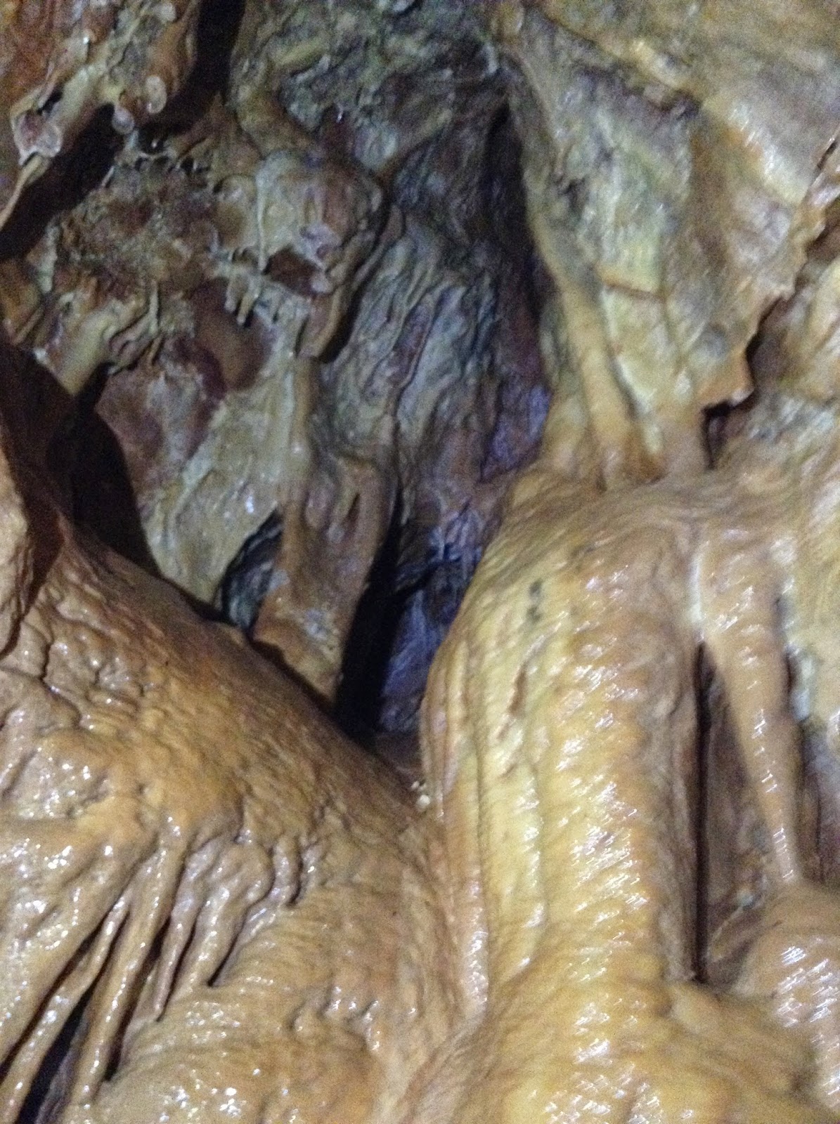
The formations in the upper rooms were not the best or that colorful, but still impressive. You can feel the cave growing.The cave is relatively young and still being formed. Most of the rock was limestone. This cave is a summer or early winter cave. In the spring, water fills up most of the cave. There are few formations down low because of the water. 
By the time we were done exploring the upper passage and had returned to the main room, it was about 6:30. We had taken off our harnesses earlier so they wouldn't get dirty as we were crawling around. We knew there was a second drop on the lower passage, so we packed our rope and harnesses into river bags and began our crawling through the lower passage. 
From reports we had read, the lower passage didn't go too far back, but within the past couple of years, the silt level had lowered so we were able to crawl through. The first crawl was about 30-40 yards long, and at the narrowest point, no more then 20 inches high. Once past that tight squeeze, the cave opened up a bit, and was about a 3 ft. high room. on the far side of that, there was a third drop of about 30 ft. 
We had brought drilling gear, but were able to natural anchor our rope. After changing into our harnesses in a small room off to the left of the third drop, we all went over. There was a fourth drop that we estimated to be about 50 ft., but the time was about 8:30. We decided to save the fourth drop for another trip, because our set return time was 10:30. 
We began our way out of the cave, and by the time we were all to the main room below the second drop, it was 9:30. 
We were out of the cave and loaded up on the four wheelers by 10:15. By the time we got back to our starting point it was 11:15, so we made a few calls notifying everyone that we were O.K. and just running behind schedule. By the time I was home, my gear was sorted and cleaned, and I was in bed, it was 12:30. What an adventure! This cave is not too popular and not even mapped. On our return trip, we hope to get down the fourth drop and do a bit of cave mapping.